Lab 12:
|
|
I. Lab Exercise
II. Selected Internet Resources
- GEO327G: GIS & GPS Applications in Earth
Sciences web pages
- Resources for
Geographers is a link list for geospatial GIS resources.
- T.N.R.I.S.
provides free DRGs, DOQQs and DEMs for Texas. Similar data for other states are
linked through the USGS national mapping program site.
- E.S.R.I., the makers of
ArcGis, ArcView and
ArcInfo, provide an online tutorial for their products.
- A comprehensive list of
well organized links to national and international GIS data is stored in a
folder in the Geo327G class folder on the server geosrv/main.
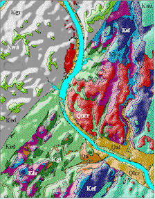
Image of a shaded relief geologic map of the
Austin West Quad., from the UTBEG
GIS website.
helper@mail.utexas.edu
Geological Sciences
U. Texas at Austin