| Field Trip #6: Mapping Precambrian Rocks, Llano Uplift |
|
|
I. Objectives
- Make a geologic map of the Cambrian/Precambrian nonconformity
on ranch property south of Streeter.
- Write concise unit descriptions of each of the map units - Riley Fm., Hickory Sandstone and Calcite/Dolomite Marbles of the Packsaddle Schist.
- Make a geologic map of folded Precambrian marble units.
II. When
- April 26 & 27
- We depart Saturday at 7:00 AM from the east basement door and will be back on campus by about 8:00 PM Sunday.
III. Bring

- Two lunches, overnight gear
- Compass, GPS, handlens, hammer
- Clipboard, field book
- Ink pens (2), colored pencils, eraser, protractor,
mech. pencil, white out.
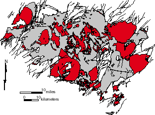
Precambrian granites (red) and host gneiss/ schist units (gray), Llano
uplift.
IV. Background Material
![]() Map
symbols for this project
Map
symbols for this project
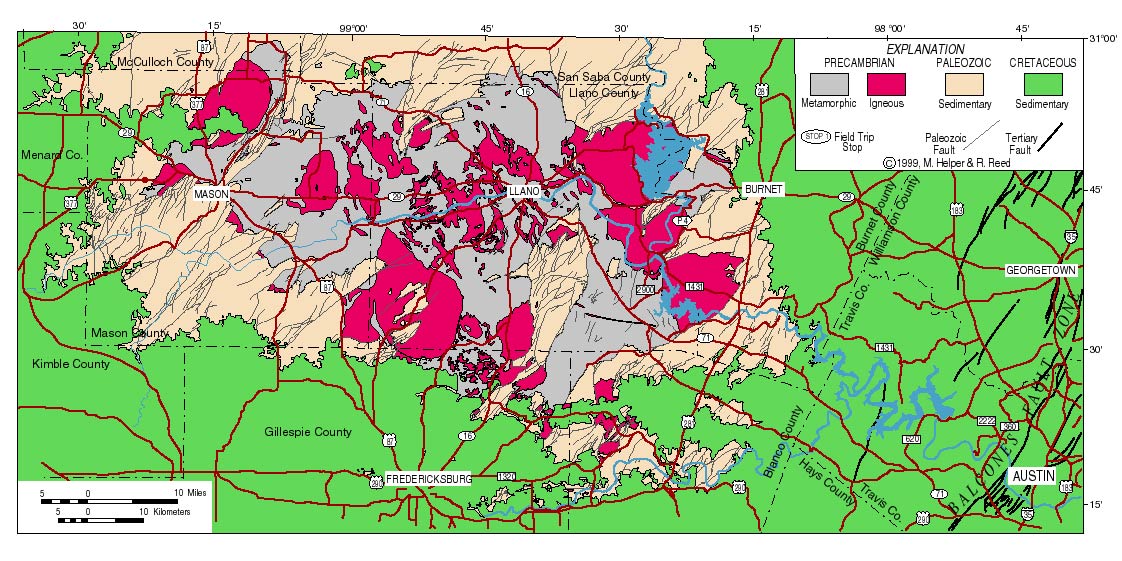
Simplified Geologic Map, Austin - Llano Area
Last Updated August 20, 2009
helper@mail.utexas.edu
Geological Sciences
U. Texas at Austin