|
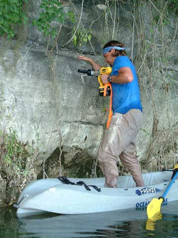
Permanent survey benchmarks have been
set and surveyed
at all LADARscanning locations, water level reference
sites,
and some intermediate points as well. Here, Marcus Gary
drills
a hole in the limestone cliff of the northwest corner of Verde to
place a water level reference bolt. The water depth underneath the
kayak he is standing on is about 50 meters.
Back to previous page
|