|
The local geologic history of Sistema Zacatón presents conditions favorable for karstification processes. Thick beds of limestone were deposited during the Late Cretaceous as the ancestral Gulf of Mexico covered the area (Enos, 1989, Goldhammer, 1999). Following aerial exposure and lithification, these limestone beds were uplifted during the late Laramide Orogenic event (40 ma), forming the Tamaulipas Arch, a 200-kilometer long domal anticline that makes up the Sierra de Tamaulipas. The axial trace of this structure is immediately west of Rancho La Azufrosa. (BELOW)
By the late
Oligocene, intrusive volcanic structures began to dissect the Sierra de
Tamaulipas. Next, the extensive volcanic field around Villa Aldama became
active in the late Pliocene, producing basaltic lava flows throughout most
of the Pleistocene (Camacho, 1993). During the period of active
volcanism, thick deposits of travertine were precipitated from springs
discharging hydrothermal, mineralized water.
Surrounding
geologic conditions allow for the development of this group of deep-seated
subsidence shafts. The surface expression results from the collapse of
large underground cavities that dissolved from circulating groundwater
(White, 1988). Recharge from the Sierra de Tamaulipas moves down gradient
through permeable limestone until reaching the Pleistocene volcanic
extrusion east of Rancho La Azufrosa where a fracture zone has provided a
line of structural weakness. A groundwater-mixing zone occurs here as
meteoric water comes into contact with hydrothermal, mineralized water
adjacent to the volcanic extrusion (BELOW). This zone provides an ideal environment for dissolution as
the mixing waters adjust to chemically equilibrate with each other.
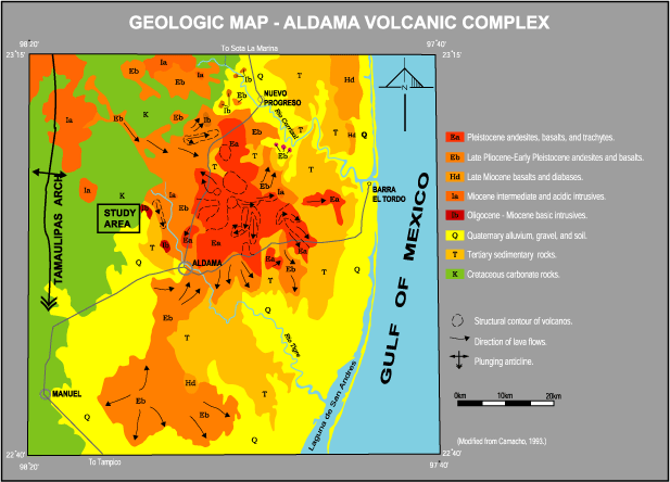
Local Grology Map
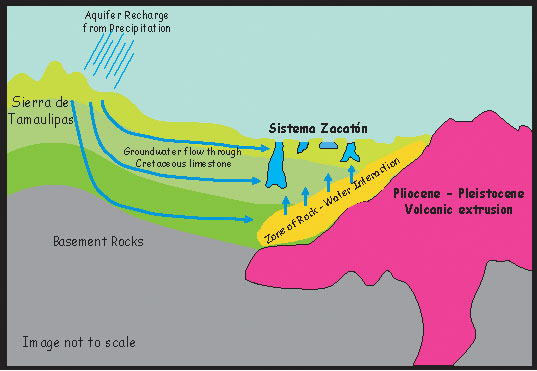
Hydrogeologic model of the area shows
primary recharge for the Sistema Zacatón
groundwater
comes from the Sierra
de Tamaulipas. As the water passes through
the Cretaceous limestone,
it approaches the Pleistocene volcanic zone that likely
continues to be a
substantial source of thermodynamic energy to drive
arge-scale
dissolution
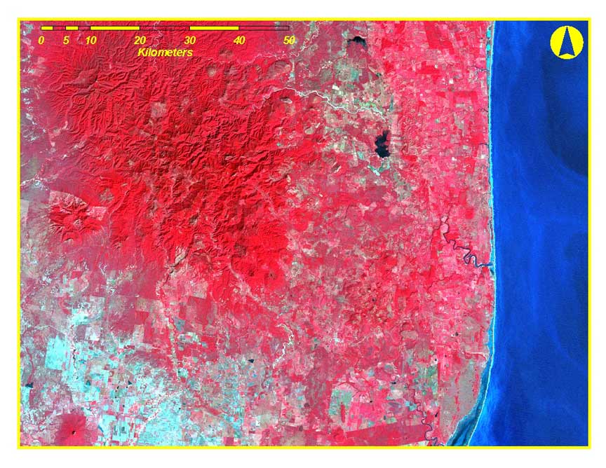
LANDSAT image
Back tp previous page
|